


उत्तराखंड का विस्तृत धरोहर मानचित्र
Open to cultural and institutional collaborations.

A glimpse into a detailed Hindi cultural map of Uttarakhand —
bringing together geography, ecology, and layered cultural history.
Designed to be read at scale, this work is meant to be experienced physically,
beyond the limits of a screen.
Watch Overview

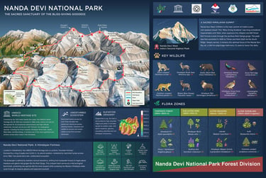
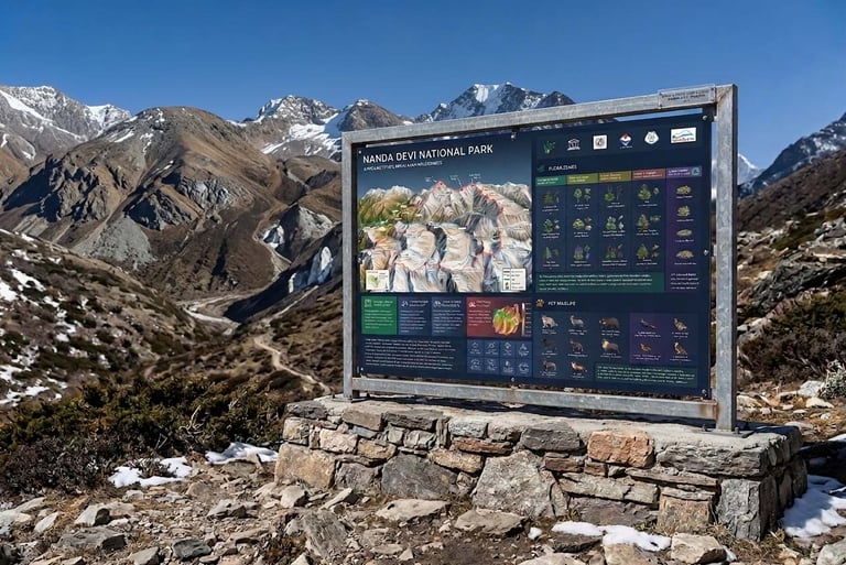
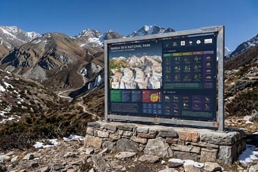
NANDA DEVI NATIONAL PARK
Infographic Map
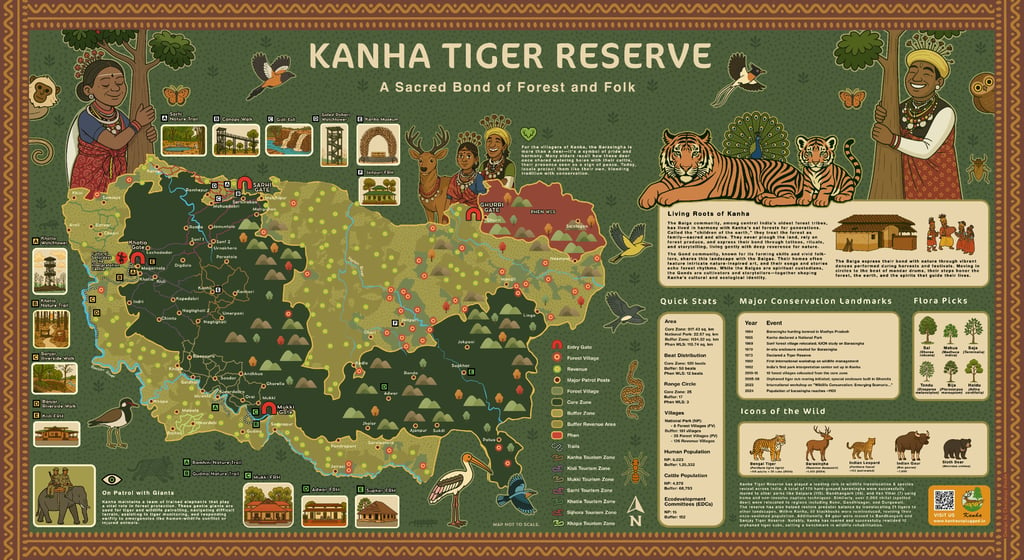

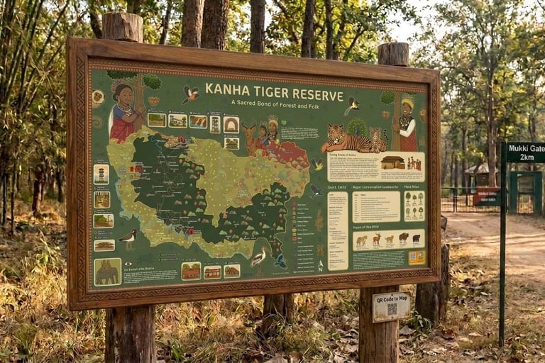
Kanha Tiger Reserve
Infographic Map
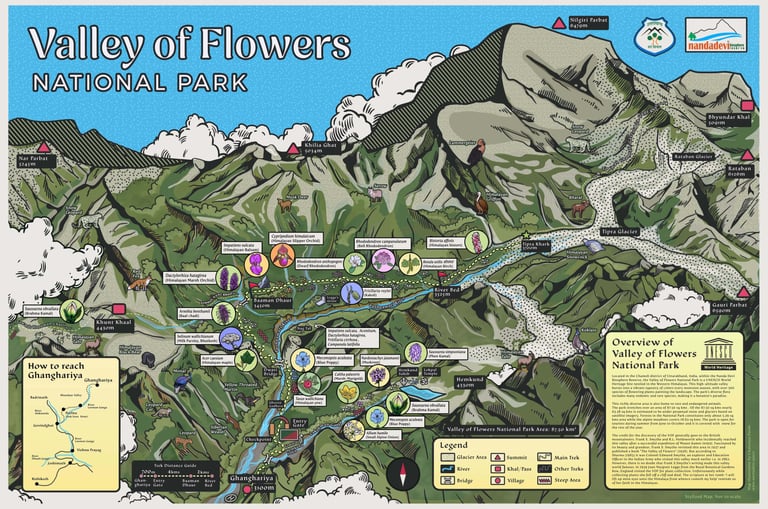

Valley of Flowers National Park
Infographic Map
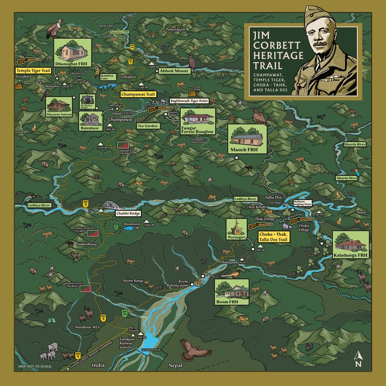

Corbett Heritage Trail Champawat
Infographic Map
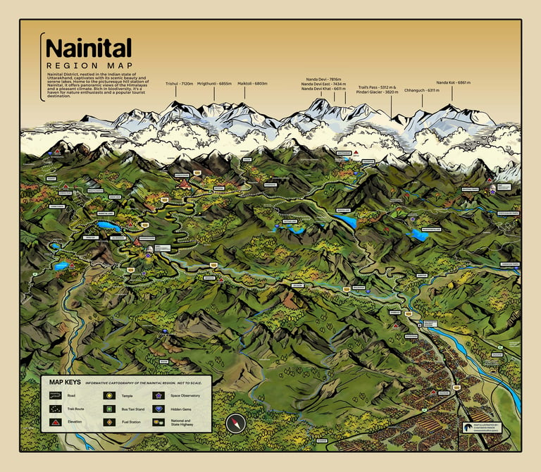

Discover Nainital :
Customizable Map
Introducing a meticulously crafted map of the Nainital district — an essential tool for businesses, travellers, and local enthusiasts.
This detailed map highlights the geographical diversity, key landmarks, and infrastructural features of the picturesque Nainital region.
The map can be customized to include specific locations and branded with your business name or logo.
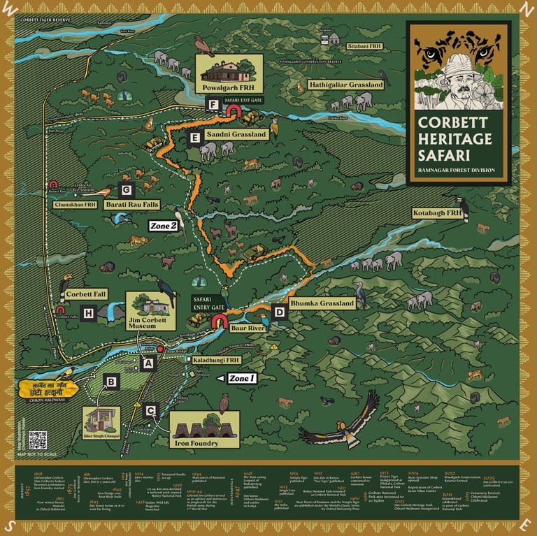
Corbett Heritage Safari
Infographic Map
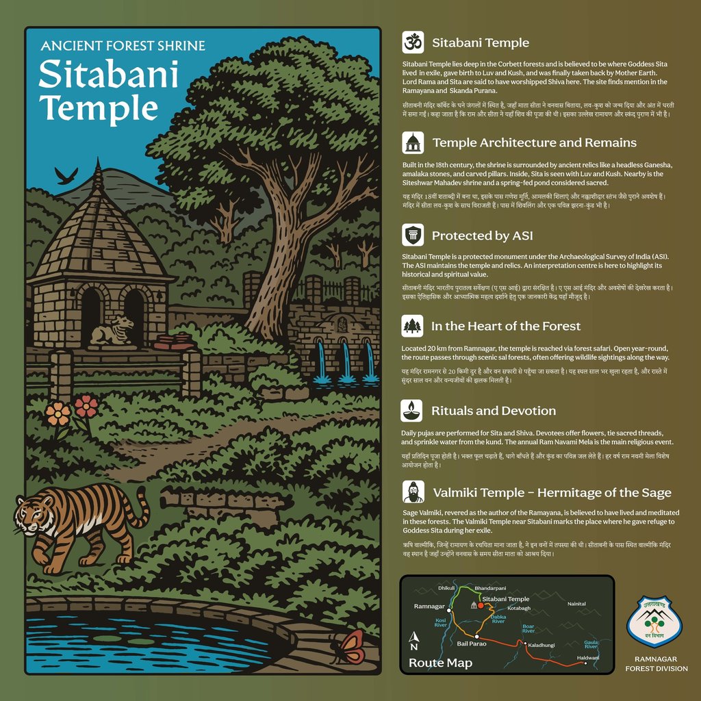

Sitabani Temple
Infographic Map
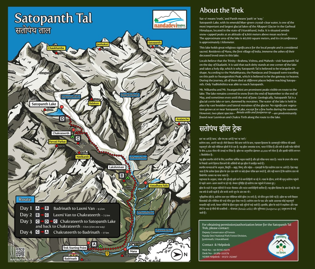

Satopanth Tal
Infographic Map
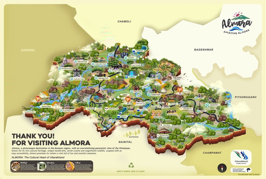

Almora District
Infographic Map


Rudraprayag District
Infographic Map


Haa Bhutan
Infographic Map

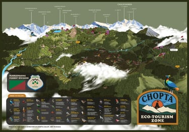
Chopta
Eco-Tourism Zone
Infographic Map
Get in touch
All artworks belong to hillbilly.in or their clients. Kindly ask us for permission at hello@hillbilly.in before using any artwork. Have a great day!
© hillbilly.in 2026
Thank you for allowing the time needed for quality work.